Geolokalisieren

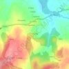
Topografische Karte Fente

Klicken Sie auf die Karte, um die Höhe anzuzeigen.

Über diese Karte

Name: Topografische Karte Fente, Höhe, Relief.

Ort: Fente, Monterroso, Ulloa, Lugo, Galicia, 27569, España (42.74154 -7.85314 42.78154 -7.81314)

Durchschnittliche Höhe: 564 m

Minimale Höhe: 495 m

Maximale Höhe: 675 m

Andere topografische Karten

Klicken Sie auf eine Karte, um ihre Topografie, ihre Höhe und ihr Relief anzuzeigen.
Palas de Rei

España > Galicia > Ulloa

Durchschnittliche Höhe: 561 m

Antas de Ulla

España > Galicia > Ulloa

Durchschnittliche Höhe: 590 m

Pidre

España > Galicia > Ulloa

Durchschnittliche Höhe: 487 m

San Miguel de Coence

España > Galicia > Ulloa

Durchschnittliche Höhe: 509 m

Monterroso

España > Galicia > Ulloa

Durchschnittliche Höhe: 585 m

Terra Chá

España > Galicia > Ulloa

Durchschnittliche Höhe: 559 m

Merlán

España > Galicia > Ulloa

Durchschnittliche Höhe: 668 m

Novelúa

España > Galicia > Ulloa

Durchschnittliche Höhe: 605 m

Lestedo

España > Galicia > Ulloa > Palas de Rei

Durchschnittliche Höhe: 610 m

Fontecuberta

España > Galicia > Ulloa

Durchschnittliche Höhe: 604 m

Senande

España > Galicia > Ulloa

Durchschnittliche Höhe: 533 m

Marzán

España > Galicia > Ulloa

Durchschnittliche Höhe: 564 m

Ligonde

España > Galicia > Ulloa > Monterroso

Durchschnittliche Höhe: 621 m

Cumbraos

España > Galicia > Ulloa > Monterroso

Durchschnittliche Höhe: 559 m

Salgueiros

España > Galicia > Ulloa > Monterroso

Durchschnittliche Höhe: 666 m

Palas de Rei

España > Galicia > Ulloa

Durchschnittliche Höhe: 559 m

Palas de Rei

España > Galicia > Ulloa

Durchschnittliche Höhe: 559 m