
Topografische Karte Padum
Interaktive Karte
Klicken Sie auf die Karte, um die Höhe anzuzeigen.
Padum
Padum is at the centre of the tri-armed Zanskar valley. It has an average elevation of 3,669 m (12,037 ft). There are several villages to the north-east of Padum leading to Karsha monastery.
Über diese Karte
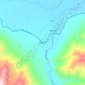
Name: Topografische Karte Padum, Höhe, Relief.
Ort: Padum, Zanskar tehsil, Ladakh, 194302, India (33.42914 76.83818 33.50914 76.91818)
Durchschnittliche Höhe: 3.847 m
Minimale Höhe: 3.491 m
Maximale Höhe: 5.332 m