Geolokalisieren
👉 Easily get elevation data in JSON, GeoTIFF and KML formats using Elevation API
Vielen Dank für die Unterstützung dieser Website ❤️
Spenden

Topografische Karte Marayoor

Klicken Sie auf die Karte, um die Höhe anzuzeigen.

👉 Easily get elevation data in JSON, GeoTIFF and KML formats using Elevation API
Vielen Dank für die Unterstützung dieser Website ❤️
Spenden

Marayoor

Ezhuthu Guha rock paintings are sited in the Koodakavu Sandalwood Reserve Forest at Marayur in the Marayur Panchayat at an elevation of 1000 meters above mean sea level. More or less 90 painted motifs can be seen here. However, as the place is the most famous rock art site in Kerala, it attracts a large number of visitors and has been extensively vandalized since it was brought to wide public attention.

Wikipedia (CC-BY-SA 3.0)

👉 Easily get elevation data in JSON, GeoTIFF and KML formats using Elevation API
Vielen Dank für die Unterstützung dieser Website ❤️
Spenden

Über diese Karte

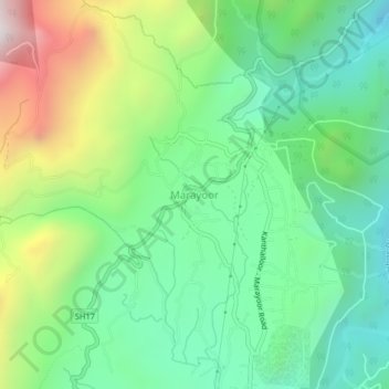
Name: Topografische Karte Marayoor, Höhe, Relief.

Ort: Marayoor, Devikulam, Idukki, Kerala, 685620, India (10.25574 77.14204 10.29574 77.18204)

Durchschnittliche Höhe: 1.071 m

Minimale Höhe: 680 m

Maximale Höhe: 1.878 m

👉 Easily get elevation data in JSON, GeoTIFF and KML formats using Elevation API
Vielen Dank für die Unterstützung dieser Website ❤️
Spenden

Andere topografische Karten

Klicken Sie auf eine Karte, um ihre Topografie, ihre Höhe und ihr Relief anzuzeigen.

Viripara

India > Kerala > Devikulam

Durchschnittliche Höhe: 1.143 m

Pallivasal

India > Kerala > Devikulam > Pallivasal

Durchschnittliche Höhe: 1.304 m

Pothupara

India > Kerala > Devikulam > Ellakkal

Durchschnittliche Höhe: 769 m

Thalamali

India > Kerala > Devikulam > Adimali

Durchschnittliche Höhe: 885 m

Vielen Dank für die Unterstützung dieser Website ❤️
Spenden

Anaimudi River

India > Kerala > Devikulam

Durchschnittliche Höhe: 1.430 m

Mattupetty Dam

India > Kerala > Devikulam > Mattupetty

Durchschnittliche Höhe: 1.665 m

Anamalai

India > Kerala > Devikulam

Durchschnittliche Höhe: 2.023 m

Eravikulam National Park

India > Kerala > Devikulam > Lakkomukudi

Durchschnittliche Höhe: 1.701 m

Vielen Dank für die Unterstützung dieser Website ❤️
Spenden