Geolokalisieren

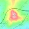
Topografische Karte Vilachá

Klicken Sie auf die Karte, um die Höhe anzuzeigen.

Über diese Karte

Name: Topografische Karte Vilachá, Höhe, Relief.

Ort: Vilachá, Lugo, Galicia, España (42.98047 -7.70995 43.00719 -7.63256)

Durchschnittliche Höhe: 527 m

Minimale Höhe: 440 m

Maximale Höhe: 679 m

Andere topografische Karten

Klicken Sie auf eine Karte, um ihre Topografie, ihre Höhe und ihr Relief anzuzeigen.

Fontemaior

España > Galicia > Lugo > Lugo

Durchschnittliche Höhe: 448 m

O Picato

España > Galicia > Lugo > Lugo

Durchschnittliche Höhe: 650 m

Astariz

España > Galicia > Lugo > Lugo

Durchschnittliche Höhe: 469 m

Santalla

España > Galicia > Lugo > Lugo

Durchschnittliche Höhe: 429 m

Segade

España > Galicia > Lugo > Lugo > Segade

Durchschnittliche Höhe: 575 m

Bagueixos

España > Galicia > Lugo > Lugo

Durchschnittliche Höhe: 452 m

Paderne

España > Galicia > Lugo > Lugo

Durchschnittliche Höhe: 581 m

Astariz

España > Galicia > Lugo > Lugo

Durchschnittliche Höhe: 469 m