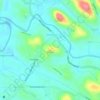
Topografische Karte Aruvappulam
Klicken Sie auf die Karte, um die Höhe anzuzeigen.
Über diese Karte

Name: Topografische Karte Aruvappulam, Höhe, Relief.
Ort: Aruvappulam, Konni, Pathanamthitta District, Kerala, India (9.07218 76.85191 9.25066 77.26714)
Durchschnittliche Höhe: 519 m
Minimale Höhe: 19 m
Maximale Höhe: 1.897 m
Andere topografische Karten
Klicken Sie auf eine Karte, um ihre Topografie, ihre Höhe und ihr Relief anzuzeigen.



Ponnambalamedu
Ponnambalamedu is located at a distance of 4 kilometres (2.5 mi) from the Sabarimala Ayyappan temple. The summit of the hill is at an altitude of 1,170 metres (3,840 ft) from mean sea level. The hill is in the Goodrickal range of the Ranni Forest Division and has been included as a part of the Periyar National…
Durchschnittliche Höhe: 890 m