

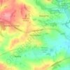
Topografische Karte River Erewash
Klicken Sie auf die Karte, um die Höhe anzuzeigen.
River Erewash
The approximate meaning of the name is not in doubt, but there is room for debate about the precise derivation and its connotations. Brewer gives the commonly accepted explanation that it comes from the Old English words irre ("wandering") and wisce ("wet meadow"). This is accepted by Kenneth Cameron, a leading placename expert and Derbyshire specialist, who interprets the name as "wandering, marshy river". Margaret Gelling, who specialises in seeking precise topographical equivalents for toponymic elements, confirms that wisce signifies a marshy meadow but gives only southern examples. She conjectures that there is an element, wæsse, perhaps Old English, that signifies very specifically "land by a meandering river which floods and drains quickly", and her examples are primarily Midland and northern. This seems to fit the Erewash perfectly. A good example of the meandering character of the river will be seen around Gallows Inn Playing Fields, Ilkeston, where rapid flooding and draining occur frequently. As it meanders through Toton and Long Eaton the river splits into two sections; the main course veers to the east and the relief channel flows over a low weir in a straight southerly direction. When there has been prolonged rainfall, the two waters are prone to bursting their banks and meet over the football pitches and the cricket pitch.
Über diese Karte

Name: Topografische Karte River Erewash, Höhe, Relief.
Durchschnittliche Höhe: 87 m
Minimale Höhe: 22 m
Maximale Höhe: 192 m
Andere topografische Karten
Klicken Sie auf eine Karte, um ihre Topografie, ihre Höhe und ihr Relief anzuzeigen.


Breadsall Hilltop
United Kingdom > England > Derbyshire > Erewash > Breadsall
Durchschnittliche Höhe: 82 m


Stanley
United Kingdom > England > Derbyshire > Erewash
The Church gates commemorate Queen Victoria's Golden Jubilee of 1887, and the churchyard contains a memorial (erected in 2004) to the five aircrew who lost their lives when an experimental high-altitude RAF Wellington Bomber disintegrated above Stanley in 1942 following a loss of cabin pressure.
Durchschnittliche Höhe: 100 m


Stanley
United Kingdom > England > Derbyshire > Erewash
The Church gates commemorate Queen Victoria's Golden Jubilee of 1887, and the churchyard contains a memorial (erected in 2004) to the five aircrew who lost their lives when an experimental high-altitude RAF Wellington Bomber disintegrated above Stanley in 1942 following a loss of cabin pressure.
Durchschnittliche Höhe: 100 m