
Topografische Karte Twentynine Palms
Interaktive Karte
Klicken Sie auf die Karte, um die Höhe anzuzeigen.
Über diese Karte
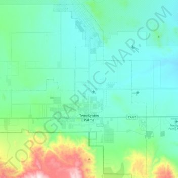
Name: Topografische Karte Twentynine Palms, Höhe, Relief.
Durchschnittliche Höhe: 690 m
Minimale Höhe: 489 m
Maximale Höhe: 1.546 m
According to the United States Census Bureau, the city has a total area of 59.1 square miles (153 km2), all land. The city is at an elevation of 1,988 feet (606 m). The Marine Corps Air Ground Combat Center Twentynine Palms is located there.