
Topografische Karte Bally
Interaktive Karte
Klicken Sie auf die Karte, um die Höhe anzuzeigen.
Über diese Karte
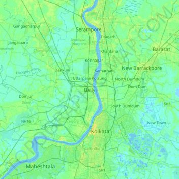
Name: Topografische Karte Bally, Höhe, Relief.
Durchschnittliche Höhe: 6 m
Minimale Höhe: -3 m
Maximale Höhe: 23 m
Bally is located at 22°39′N 88°20′E / 22.65°N 88.34°E / 22.65; 88.34 and also the northern-most part of Howrah city. It has an average elevation of 15 metres (49 feet). Bally is separated from Uttarpara, Hooghly by Bally Canal (Bally Khal) at its north. A Bridge was constructed over Bally Canal in 1846 to join the two localities.