
Spenden
Topografische Karte Ashburn
Klicken Sie auf die Karte, um die Höhe anzuzeigen.
Spenden
Ashburn
Ashburn is located at 39°02′37″N 077°29′15″W / 39.04361°N 77.48750°W / 39.04361; -77.48750 (39.0437192, −77.4874899) and its average elevation is 295 feet (90 m) above sea level. According to the 2010 United States Census, the CDP has a total area of 17.287 square miles (44.77 km2), of which 17.025 square miles (44.09 km2) is land and 0.262 square miles (0.68 km2) is water. Ashburn is located between Washington Dulles International Airport and Leesburg, the county seat of Loudoun County.
Spenden
Über diese Karte
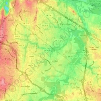
Name: Topografische Karte Ashburn, Höhe, Relief.
Ort: Ashburn, Loudoun County, Virginia, United States (38.98815 -77.52292 39.07145 -77.43125)
Durchschnittliche Höhe: 86 m
Minimale Höhe: 36 m
Maximale Höhe: 144 m
Spenden