
Vielen Dank für die Unterstützung dieser Website ❤️
Spenden
Spenden
Topografische Karte Guímara
Klicken Sie auf die Karte, um die Höhe anzuzeigen.
Vielen Dank für die Unterstützung dieser Website ❤️
Spenden
Spenden
Über diese Karte
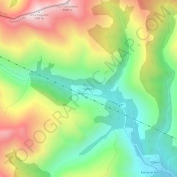
Name: Topografische Karte Guímara, Höhe, Relief.
Ort: Guímara, Peranzanes, El Bierzo, León, Castilla y León, España (42.87930 -6.70969 42.91930 -6.66969)
Durchschnittliche Höhe: 1.370 m
Minimale Höhe: 956 m
Maximale Höhe: 1.948 m
Vielen Dank für die Unterstützung dieser Website ❤️
Spenden
Spenden