
Spenden
Topografische Karte Cheapside
Klicken Sie auf die Karte, um die Höhe anzuzeigen.
Spenden
Über diese Karte
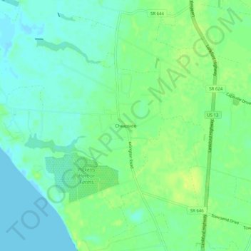
Name: Topografische Karte Cheapside, Höhe, Relief.
Durchschnittliche Höhe: 8 m
Minimale Höhe: -5 m
Maximale Höhe: 17 m
Spenden
Andere topografische Karten
Klicken Sie auf eine Karte, um ihre Topografie, ihre Höhe und ihr Relief anzuzeigen.
Cape Charles
United States > Virginia > Northampton County
Cape Charles lies on a peninsula and is surrounded by water on three sides. The town is situated directly on the Chesapeake Bay, bordered by King's Creek to the north and Old Plantation Creek to the south. The land in town is low lying and relatively flat, with the highest point of elevation at 15 feet, and a…
Durchschnittliche Höhe: 2 m
Spenden