
Topografische Karte Sierra de Guadarrama
Interaktive Karte
Klicken Sie auf die Karte, um die Höhe anzuzeigen.
Über diese Karte
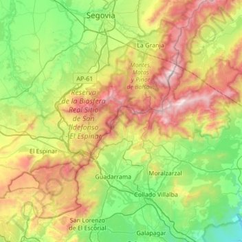
Name: Topografische Karte Sierra de Guadarrama, Höhe, Relief.
Durchschnittliche Höhe: 1.241 m
Minimale Höhe: 640 m
Maximale Höhe: 2.421 m
The range runs southwest–northeast, extending from the province of Ávila in the southwest, through the Community of Madrid, to the province of Segovia in the northeast. The range measures approximately 80 kilometres (50 mi) in length. Its highest peak is Peñalara, 2,428 metres (7,966 ft) in elevation.