
Spenden
Topografische Karte Cagayancillo
Klicken Sie auf die Karte, um die Höhe anzuzeigen.
Spenden
Cagayancillo
There are neither mountain ranges nor forested areas in the municipality. A hilly portion in the north-eastern part of the main island has a slope of 3-82%. The other areas are flat with the highest elevation around 2 to 3 meters. The majority of the island has a sandy loam soil not enough to support a forest.
Spenden
Über diese Karte
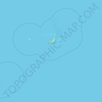
Name: Topografische Karte Cagayancillo, Höhe, Relief.
Ort: Cagayancillo, Palawan, Mimaropa, 5321, Philippines (9.10244 120.61298 9.87678 121.47167)
Durchschnittliche Höhe: 0 m
Minimale Höhe: 0 m
Maximale Höhe: 57 m
Spenden
Andere topografische Karten
Klicken Sie auf eine Karte, um ihre Topografie, ihre Höhe und ihr Relief anzuzeigen.
Spenden
Spenden
Spenden
Spenden
Spenden
Spenden
Spenden
Spenden
Spenden
Spenden
Spenden
Spenden
Spenden
Spenden
Spenden
Spenden
Spenden
Spenden
Spenden
Likas Island
Philippines > Palawan > Kalayaan
West York Island, also known as Likas Island (Filipino: Pulo ng Likas, lit. 'Island of Naturality'; Mandarin Chinese: 西月島/西月岛; pinyin: Xīyuè Dǎo; Vietnamese: đảo Bến Lạc), and several other names. With an area of 18.6 hectares (46 acres), it is the third largest of the naturally…
Durchschnittliche Höhe: 0 m
Spenden
Spenden
Spenden
Spenden
Spenden
Spenden