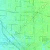
Topografische Karte Stanislaus River
Klicken Sie auf die Karte, um die Höhe anzuzeigen.
Stanislaus River
The Stanislaus River watershed drains 1,075 square miles (2,780 km2) and is divided into two distinct sections – the mountainous upper watershed, where the vast majority of its flow originates, and the narrow, heavily developed lower watershed where it flows across the San Joaquin Valley. Goodwin Dam has traditionally been considered the dividing line between the upper and lower watersheds. Elevations in the watershed range from less than 15 feet (4.6 m) at the confluence with the San Joaquin River to over 10,000 feet (3,000 m) in the high Sierra Nevada. Annual precipitation varies from 20 inches (510 mm) in the valley regions to 50 inches (1,300 mm) or more at higher elevations; at elevations above 5,000 feet (1,500 m) most precipitation falls as snow.
Über diese Karte

Name: Topografische Karte Stanislaus River, Höhe, Relief.
Durchschnittliche Höhe: 85 m
Minimale Höhe: 5 m
Maximale Höhe: 876 m
Andere topografische Karten
Klicken Sie auf eine Karte, um ihre Topografie, ihre Höhe und ihr Relief anzuzeigen.