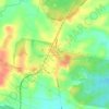
Topografische Karte Alexandra Hills
Klicken Sie auf die Karte, um die Höhe anzuzeigen.
Alexandra Hills
Scribbly Gums Conservation Area is located on the eastern edge of Alexandra Hills, bordered by Redland Hospital to the east, and Flinders St and Winchester Rd to the north. The conservation area occupies approximately 152 hectares and contains the Redlands Track Park - a collection of 30+ mountain bike trails totalling over 32km in length. The conservation area is also home to the Scribbly Gums Conservation parkrun, which started in October 2022. It's one of the more challenging parkruns in the bayside area, being entirely offroad and with a total elevation change of around 90m.
Über diese Karte

Name: Topografische Karte Alexandra Hills, Höhe, Relief.
Durchschnittliche Höhe: 34 m
Minimale Höhe: 2 m
Maximale Höhe: 72 m
Andere topografische Karten
Klicken Sie auf eine Karte, um ihre Topografie, ihre Höhe und ihr Relief anzuzeigen.