Geolokalisieren
👉 Easily get elevation data in JSON, GeoTIFF and KML formats using Elevation API
Vielen Dank für die Unterstützung dieser Website ❤️
Spenden

Topografische Karte Kurusadai

Klicken Sie auf die Karte, um die Höhe anzuzeigen.

👉 Easily get elevation data in JSON, GeoTIFF and KML formats using Elevation API
Vielen Dank für die Unterstützung dieser Website ❤️
Spenden

Über diese Karte

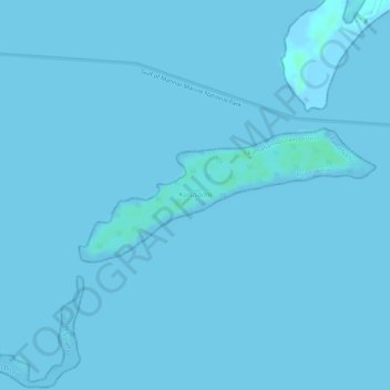
Name: Topografische Karte Kurusadai, Höhe, Relief.

Ort: Kurusadai, Rameswaram, Ramanathapuram District, Tamil Nadu, India (9.24148 79.20119 9.25072 79.22199)

Durchschnittliche Höhe: 0 m

Minimale Höhe: -2 m

Maximale Höhe: 5 m

👉 Easily get elevation data in JSON, GeoTIFF and KML formats using Elevation API
Vielen Dank für die Unterstützung dieser Website ❤️
Spenden

Andere topografische Karten

Klicken Sie auf eine Karte, um ihre Topografie, ihre Höhe und ihr Relief anzuzeigen.

Rameswaram

India > Tamil Nadu > Rameswaram

Rameswaram has an average elevation of 10 m (33 ft). The island is spread across an area of 61.8 km2 (23.9 sq mi) and is in the shape of a conch. 74% of the area has sandy soil due to the presence of sea and it has many islands surrounding it, the Palk Strait in the north west and Gulf of Mannar in the south…

Durchschnittliche Höhe: 3 m

Thangachimadam

India > Tamil Nadu > Rameswaram

Durchschnittliche Höhe: 4 m

Adam's Bridge

India > Tamil Nadu > Rameswaram

Durchschnittliche Höhe: 0 m