
Vielen Dank für die Unterstützung dieser Website ❤️
Spenden
Spenden
Topografische Karte Kanlaon
Klicken Sie auf die Karte, um die Höhe anzuzeigen.
Vielen Dank für die Unterstützung dieser Website ❤️
Spenden
Spenden
Kanlaon
Kanlaon, also known as Mount Kanlaon and Kanlaon Volcano (Hiligaynon: Bolkang Kanglaon; Cebuano: Bolkang Kanglaon; Filipino: Bulkang Kanlaon), is an active andesitic stratovolcano and the highest mountain on the island of Negros in the Philippines, as well as the highest peak in the Visayas, with an elevation of 2,465 m (8,087 ft) above sea level. Mount Kanlaon ranks as the 42nd-highest peak of an island in the world.
Vielen Dank für die Unterstützung dieser Website ❤️
Spenden
Spenden
Über diese Karte
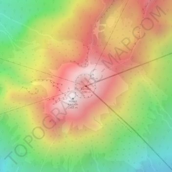
Name: Topografische Karte Kanlaon, Höhe, Relief.
Durchschnittliche Höhe: 1.959 m
Minimale Höhe: 1.391 m
Maximale Höhe: 2.430 m
Vielen Dank für die Unterstützung dieser Website ❤️
Spenden
Spenden