

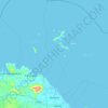
Topografische Karte Mangkasay
Klicken Sie auf die Karte, um die Höhe anzuzeigen.
Über diese Karte
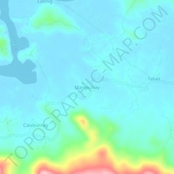
Name: Topografische Karte Mangkasay, Höhe, Relief.
Ort: Mangkasay, Camarines Norte, Bicol Region, Philippines (14.23374 122.80077 14.27374 122.84077)
Durchschnittliche Höhe: 29 m
Minimale Höhe: 0 m
Maximale Höhe: 191 m
Andere topografische Karten
Klicken Sie auf eine Karte, um ihre Topografie, ihre Höhe und ihr Relief anzuzeigen.


Daet
Daet is located in the southeastern part of Camarines Norte. It is bounded in the east by the town of Mercedes; in the south by the municipality of Basud; in southwest by San Lorenzo Ruiz town; in the north by Pacific Ocean; in the west by San Vicente and northwest by Talisay. The provincial capital covers a…
Durchschnittliche Höhe: 8 m


Bicol Natural Park
Philippines > Camarines Norte > Basud
The Bicol Natural Park spreads across the Camarines Norte municipalities of Basud and Mercedes, and the Camarines Sur municipalities of Sipocot and Lupi. It is situated at an elevation of 536 metres (1,759 ft) above sea level bordered by the Tuaca River to the north, the agricultural lands of Sipocot and Lupi…
Durchschnittliche Höhe: 191 m
Daet
Daet is located in the southeastern part of Camarines Norte. It is bounded in the east by the town of Mercedes; in the south by the municipality of Basud; in southwest by San Lorenzo Ruiz town; in the north by Pacific Ocean; in the west by San Vicente and northwest by Talisay. The provincial capital covers a…
Durchschnittliche Höhe: 6 m
Daet
Daet is located in the southeastern part of Camarines Norte. It is bounded in the east by the town of Mercedes; in the south by the municipality of Basud; in southwest by San Lorenzo Ruiz town; in the north by Pacific Ocean; in the west by San Vicente and northwest by Talisay. The provincial capital covers a…
Durchschnittliche Höhe: 6 m
Daet
Daet is located in the southeastern part of Camarines Norte. It is bounded in the east by the town of Mercedes; in the south by the municipality of Basud; in southwest by San Lorenzo Ruiz town; in the north by Pacific Ocean; in the west by San Vicente and northwest by Talisay. The provincial capital covers a…
Durchschnittliche Höhe: 6 m
Daet
Daet is located in the southeastern part of Camarines Norte. It is bounded in the east by the town of Mercedes; in the south by the municipality of Basud; in southwest by San Lorenzo Ruiz town; in the north by Pacific Ocean; in the west by San Vicente and northwest by Talisay. The provincial capital covers a…
Durchschnittliche Höhe: 6 m