
Topografische Karte Shivpuri
Interaktive Karte
Klicken Sie auf die Karte, um die Höhe anzuzeigen.
Shivpuri
Shivpuri is a city and a municipality in Shivpuri district located in the central Indian state of Madhya Pradesh. It is in the Gwalior Division of northwest Madhya Pradesh and is the administrative headquarters of Shivpuri District. It is situated at an altitude of 1,515 feet (462 m) above sea level.
Über diese Karte
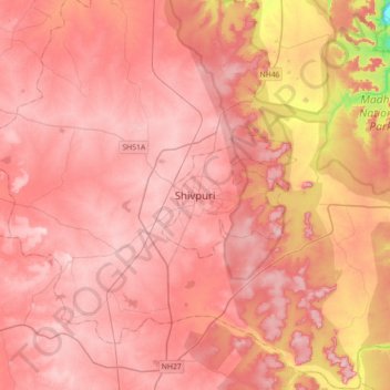
Name: Topografische Karte Shivpuri, Höhe, Relief.
Durchschnittliche Höhe: 442 m
Minimale Höhe: 284 m
Maximale Höhe: 501 m