
Topografische Karte Safidon
Interaktive Karte
Klicken Sie auf die Karte, um die Höhe anzuzeigen.
Über diese Karte
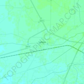
Name: Topografische Karte Safidon, Höhe, Relief.
Ort: Safidon, Jind District, Haryana, 125112, India (29.36476 76.61991 29.44476 76.69991)
Durchschnittliche Höhe: 235 m
Minimale Höhe: 232 m
Maximale Höhe: 238 m
The elevation of Safidon is about 221 m (725 ft) above sea level. The fertile land of Safidon paves the way for the growth of crops such as wheat, paddy, sugarcane, millets, pulses, vegetables and fruits; accompanied by well developed irrigation facilities. The groundwater of some villages like Anta, Rampura, Khera Khemawati, Chapper are considered to be the best in Jind district.