
Topografische Karte Crowborough
Interaktive Karte
Klicken Sie auf die Karte, um die Höhe anzuzeigen.
Über diese Karte
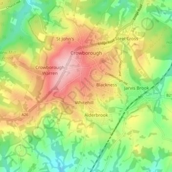
Name: Topografische Karte Crowborough, Höhe, Relief.
Durchschnittliche Höhe: 146 m
Minimale Höhe: 64 m
Maximale Höhe: 244 m
In the late 19th century, Crowborough was promoted as a health resort based on its high elevation, the rolling hills and surrounding forest. Estate Agents even called it "Scotland in Sussex". The town's golf course opened in 1895, followed by a fire station and hospital in 1900.