Geolokalisieren
👉 Easily get elevation data in JSON, GeoTIFF and KML formats using Elevation API
Vielen Dank für die Unterstützung dieser Website ❤️
Spenden

Topografische Karte Mount Pangasun

Klicken Sie auf die Karte, um die Höhe anzuzeigen.

👉 Easily get elevation data in JSON, GeoTIFF and KML formats using Elevation API
Vielen Dank für die Unterstützung dieser Website ❤️
Spenden

Mount Pangasun

Babuyan Claro is a stratovolcano with an elevation of 843 meters (2,766 ft) and a base diameter of about 8 kilometers (5.0 mi) located in the center of Babuyan Island (also referred to as Babuyan Claro Island). It has four morphologically-fresh volcanic edifices: Mt. Cayonan in the south, Mt. Naydi and Mt. Dionisio in the southeast. Babuyan Claro has two very well-preserved craters 300 and 400 meters (980 and 1,310 ft) in diameter.

Wikipedia (CC-BY-SA 3.0)

👉 Easily get elevation data in JSON, GeoTIFF and KML formats using Elevation API
Vielen Dank für die Unterstützung dieser Website ❤️
Spenden

Über diese Karte

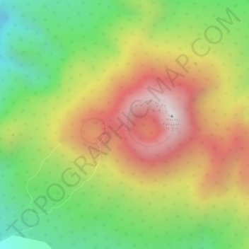
Name: Topografische Karte Mount Pangasun, Höhe, Relief.

Ort: Mount Pangasun, Calayan, Cagayan, Cagayan Valley, Philippines (19.52495 121.95238 19.52505 121.95248)

Durchschnittliche Höhe: 688 m

Minimale Höhe: 380 m

Maximale Höhe: 1.061 m

👉 Easily get elevation data in JSON, GeoTIFF and KML formats using Elevation API
Vielen Dank für die Unterstützung dieser Website ❤️
Spenden

Andere topografische Karten

Klicken Sie auf eine Karte, um ihre Topografie, ihre Höhe und ihr Relief anzuzeigen.

Babuyan Island

Philippines > Cagayan > Calayan

Durchschnittliche Höhe: 185 m

Babuyan Island

Philippines > Cagayan > Calayan

Durchschnittliche Höhe: 185 m