Topografische Karte Sector 74
Interaktive Karte
Klicken Sie auf die Karte, um die Höhe anzuzeigen.
Über diese Karte
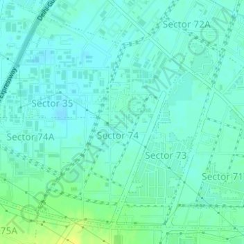
Name: Topografische Karte Sector 74, Höhe, Relief.
Ort: Sector 74, Gurgaon, Gurugram, Haryana, India (28.40083 77.00001 28.42408 77.01970)
Durchschnittliche Höhe: 225 m
Minimale Höhe: 219 m
Maximale Höhe: 238 m
Andere topografische Karten
Klicken Sie auf eine Karte, um ihre Topografie, ihre Höhe und ihr Relief anzuzeigen.
Damdama Lake
Damdama Lake, Asola, Sohna, Gurugram, Haryana, India
Durchschnittliche Höhe: 242 m
Sikanderpur
Sikanderpur, Sector 26, Gurgaon, Gurugram, Haryana, India
Durchschnittliche Höhe: 251 m
Najafgarh Jheel
India > Haryana > Gurugram > Daultalbad Village
Najafgarh Jheel, Daultalbad Village, Sector 103, Gurugram, Daultalbad Village, Gurgaon, Haryana, India
Durchschnittliche Höhe: 211 m
Sector 104
Sector 104, Gurgaon, Gurugram, Haryana, 122006, India
Durchschnittliche Höhe: 215 m
Gurgaon One
Gurgaon One, Sector 84, Gurgaon, Gurugram, Haryana, India
Durchschnittliche Höhe: 228 m
Sector 112
Sector 112, Gurgaon, Gurugram, Haryana, India
Durchschnittliche Höhe: 214 m
Cyber City
Cyber City, Sector 25A, Gurugram, Gurgaon, Haryana, India
Durchschnittliche Höhe: 244 m
Sector 108
India > Haryana > Gurugram > Dharampur
Sector 108, Dharampur, Gurugram, Gurgaon, Haryana, India
Durchschnittliche Höhe: 212 m
Gwal Pahari
Gwal Pahari, Sohna, Gurugram, Haryana, India
Durchschnittliche Höhe: 253 m
Chander Nagar
Chander Nagar, Sector 15-II, Gurugram, Haryana, 122001, India
Durchschnittliche Höhe: 229 m
Ambience Island
Ambience Island, Gurugram, Haryana, India
Durchschnittliche Höhe: 247 m