
Topografische Karte Devín Castle
Interaktive Karte
Klicken Sie auf die Karte, um die Höhe anzuzeigen.
Über diese Karte
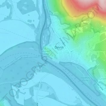
Name: Topografische Karte Devín Castle, Höhe, Relief.
Durchschnittliche Höhe: 175 m
Minimale Höhe: 137 m
Maximale Höhe: 453 m
The cliff (elevation 212 meters) is an ideal place for a fort due to its position at the confluence of the Danube and Morava rivers. The fort watches over an important trade route along the Danube as well as one branch of the Amber Road.