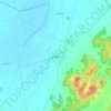
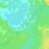
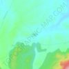
Topografische Karte La Roda
Klicken Sie auf die Karte, um die Höhe anzuzeigen.
La Roda
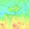
The extensive municipal area features a flat terrain characteristic of the La Mancha Alta Albaceteña region. It is situated 716 meters (2349 feet) above sea level, with the southwestern edge of the municipality reaching higher elevations (over 850 meters, 2788 feet) near the Campo de Montiel.
Über diese Karte

Name: Topografische Karte La Roda, Höhe, Relief.
Ort: La Roda, Albacete, Castile-La Mancha, 02630, Spain (39.05713 -2.38176 39.28107 -2.00585)
Durchschnittliche Höhe: 724 m
Minimale Höhe: 648 m
Maximale Höhe: 958 m
Andere topografische Karten
Klicken Sie auf eine Karte, um ihre Topografie, ihre Höhe und ihr Relief anzuzeigen.



Sierra Morena
Spain > Castile-La Mancha > Sierra Morena > Fuencaliente
Durchschnittliche Höhe: 1.070 m



Alto del Campo
Spain > Castile-La Mancha > Señorío de Molina > Fuentelsaz
Durchschnittliche Höhe: 1.198 m
Valderacete
Spain > Castile-La Mancha > Toledo > Villaluenga de la Sagra
Durchschnittliche Höhe: 533 m