Geolokalisieren
👉 Easily get elevation data in JSON, GeoTIFF and KML formats using Elevation API
Vielen Dank für die Unterstützung dieser Website ❤️
Spenden

Topografische Karte Elgin

Klicken Sie auf die Karte, um die Höhe anzuzeigen.

👉 Easily get elevation data in JSON, GeoTIFF and KML formats using Elevation API
Vielen Dank für die Unterstützung dieser Website ❤️
Spenden

Über diese Karte

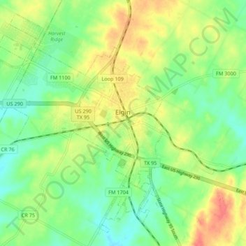
Name: Topografische Karte Elgin, Höhe, Relief.

Ort: Elgin, Bastrop County, Texas, United States (30.31424 -97.43934 30.37828 -97.35623)

Durchschnittliche Höhe: 167 m

Minimale Höhe: 145 m

Maximale Höhe: 197 m

👉 Easily get elevation data in JSON, GeoTIFF and KML formats using Elevation API
Vielen Dank für die Unterstützung dieser Website ❤️
Spenden

Andere topografische Karten

Klicken Sie auf eine Karte, um ihre Topografie, ihre Höhe und ihr Relief anzuzeigen.

McDade

United States > Texas > Bastrop County

Durchschnittliche Höhe: 162 m

Cedar Creek

United States > Texas > Bastrop County

Durchschnittliche Höhe: 125 m

Rosanky

United States > Texas > Bastrop County

Durchschnittliche Höhe: 153 m

Circle D-KC Estates

United States > Texas > Bastrop County

Durchschnittliche Höhe: 159 m

Vielen Dank für die Unterstützung dieser Website ❤️
Spenden

Antioch

United States > Texas > Bastrop County

Durchschnittliche Höhe: 149 m

Paige

United States > Texas > Bastrop County

Durchschnittliche Höhe: 161 m

Rosanky

United States > Texas > Bastrop County

Durchschnittliche Höhe: 153 m

High Point

United States > Texas > Bastrop County

Durchschnittliche Höhe: 145 m

Vielen Dank für die Unterstützung dieser Website ❤️
Spenden

Red Rock

United States > Texas > Bastrop County

Durchschnittliche Höhe: 152 m