

Topografische Karte Molave
Klicken Sie auf die Karte, um die Höhe anzuzeigen.
Molave
Molave is divided into two topographical areas. The east and southwest lowlands, which cover 30 percent of its total land area, consist of nine barangays and are generally flat, swampy and marshy. The upland, which covers 70 percent of Molave's total area, is hilly and mostly deforested. The terrain is moderately sloping to rolling, with the overall grade varying from 10 percent in the lowlands to 27 percent in the mountains.
Über diese Karte
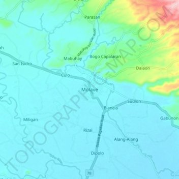
Name: Topografische Karte Molave, Höhe, Relief.
Durchschnittliche Höhe: 41 m
Minimale Höhe: 10 m
Maximale Höhe: 240 m
Andere topografische Karten
Klicken Sie auf eine Karte, um ihre Topografie, ihre Höhe und ihr Relief anzuzeigen.

