
Topografische Karte Punta do Carballo
Klicken Sie auf die Karte, um die Höhe anzuzeigen.
Über diese Karte
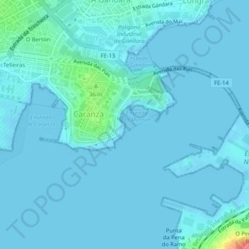
Name: Topografische Karte Punta do Carballo, Höhe, Relief.
Durchschnittliche Höhe: 6 m
Minimale Höhe: -3 m
Maximale Höhe: 85 m
Andere topografische Karten
Klicken Sie auf eine Karte, um ihre Topografie, ihre Höhe und ihr Relief anzuzeigen.
Serantes
España > Galicia > Ferrol > Ferrol
La ermita, construida en el siglo XVI, está situada en la ladera del monte del mismo nombre y desde su atrio, a 175 m de altitud, se contempla una magnífica vista panorámica de la comarca ferrolana, con el valle de Serantes en primer término y al fondo la ciudad de Ferrol. Esta ermita tiene una extraña y…
Durchschnittliche Höhe: 85 m