
Vielen Dank für die Unterstützung dieser Website ❤️
Spenden
Spenden
Topografische Karte Notre Dame Mountains
Klicken Sie auf die Karte, um die Höhe anzuzeigen.
Vielen Dank für die Unterstützung dieser Website ❤️
Spenden
Spenden
Notre Dame Mountains
The Chic-Choc Mountains are one of the primary subranges of the Notre Dame Mountains. They are located in the northeastern part of the Gaspé Peninsula and are home to the tallest mountain in the range, Mont Jacques-Cartier, with an elevation of 1,268 m (4,160 ft). The other major subsection of the Notre Dame Mountains is the Massif du Sud, which is found in the southern part of the range, southeast of Quebec City, and reaches an elevation of 915 m (3,002 ft).
Vielen Dank für die Unterstützung dieser Website ❤️
Spenden
Spenden
Über diese Karte
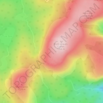
Name: Topografische Karte Notre Dame Mountains, Höhe, Relief.
Durchschnittliche Höhe: 1.128 m
Minimale Höhe: 925 m
Maximale Höhe: 1.276 m
Vielen Dank für die Unterstützung dieser Website ❤️
Spenden
Spenden