
Topografische Karte Sullurpeta
Interaktive Karte
Klicken Sie auf die Karte, um die Höhe anzuzeigen.
Über diese Karte
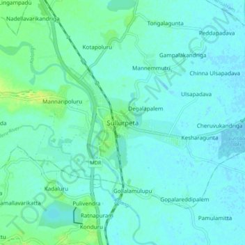
Name: Topografische Karte Sullurpeta, Höhe, Relief.
Ort: Sullurpeta, Tirupati District, Andhra Pradesh, 524121, India (13.66129 79.98070 13.74129 80.06070)
Durchschnittliche Höhe: 4 m
Minimale Höhe: -2 m
Maximale Höhe: 15 m
Sullurupeta is located about 77 km east of Tirupati, 90 km south of Nellore and about 83 km north of Chennai, Tamilnadu. It is 16 km west of the world-famous ISRO island Sriharikota, where the Indian rockets are launched. The Pulicat lake separates Sullurpeta and Sriharikota. It has an average elevation of 11 meters (36 feet).