
Topografische Karte Brookings County
Interaktive Karte
Klicken Sie auf die Karte, um die Höhe anzuzeigen.
Brookings County
Brookings County is on the east side of South Dakota. Its east boundary line abuts the west boundary line of the state of Minnesota. The Big Sioux River flows south-southeastward through the east central part of the county; its point of entry into Moody County marks Brookings County's lowest elevation: 1,568' (478m) ASL.
Über diese Karte
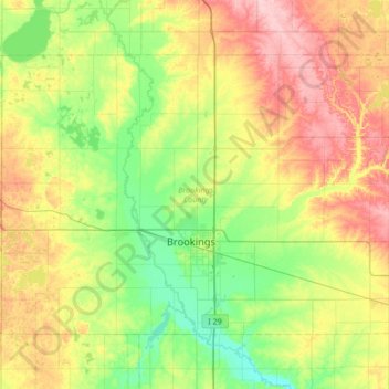
Name: Topografische Karte Brookings County, Höhe, Relief.
Ort: Brookings County, South Dakota, United States (44.19593 -97.12974 44.54378 -96.45182)
Durchschnittliche Höhe: 525 m
Minimale Höhe: 472 m
Maximale Höhe: 617 m