
Topografische Karte Mabaruma - Kumaka - Hosororo
Interaktive Karte
Klicken Sie auf die Karte, um die Höhe anzuzeigen.
Über diese Karte
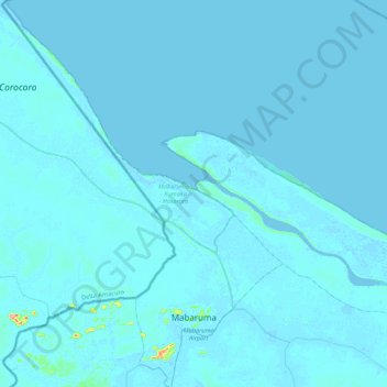
Name: Topografische Karte Mabaruma - Kumaka - Hosororo, Höhe, Relief.
Durchschnittliche Höhe: 2 m
Minimale Höhe: -2 m
Maximale Höhe: 140 m
Mabaruma is the administrative centre and regional capital for Region One (Barima-Waini) of Guyana. It is located close to the Aruka River (the Venezuelan border) on a narrow plateau above the surrounding rainforest at an elevation of 13 metres.
Andere topografische Karten
Klicken Sie auf eine Karte, um ihre Topografie, ihre Höhe und ihr Relief anzuzeigen.
Baramita
Guyana > Barima-Waini > Baramita
Baramita, Rest of Region 1, Barima-Waini, Guyana
Durchschnittliche Höhe: 118 m