
Topografische Karte Indravati National Park
Interaktive Karte
Klicken Sie auf die Karte, um die Höhe anzuzeigen.
Indravati National Park
The topography of the park mainly comprises undulating hilly terrain with altitude ranging between 177 and 599 metres above the sea level.
Über diese Karte
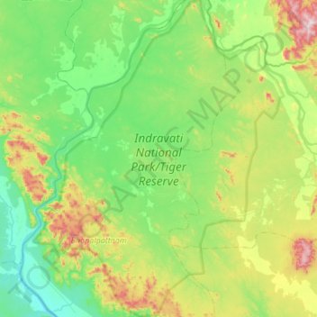
Name: Topografische Karte Indravati National Park, Höhe, Relief.
Durchschnittliche Höhe: 253 m
Minimale Höhe: 90 m
Maximale Höhe: 732 m