

Topografische Karte Coniston Water
Klicken Sie auf die Karte, um die Höhe anzuzeigen.
Coniston Water
Coniston Water in the English county of Cumbria is the third-largest lake in the Lake District by volume (after Windermere and Ullswater), and the fifth-largest by area. It is five miles long by half a mile wide (8 km by 800 m), has a maximum depth of 184 feet (56 m), and covers an area of 1.89 square miles (4.9 km2). The lake has an elevation of 143 feet (44 m) above sea level. It drains to the sea via the River Crake.
Über diese Karte
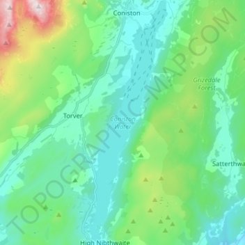
Name: Topografische Karte Coniston Water, Höhe, Relief.
Durchschnittliche Höhe: 186 m
Minimale Höhe: 17 m
Maximale Höhe: 791 m
Andere topografische Karten
Klicken Sie auf eine Karte, um ihre Topografie, ihre Höhe und ihr Relief anzuzeigen.
Whitestone Moss
United Kingdom > England > Cumbria > South Lakeland > High Nibthwaite > Houkler Hall
Durchschnittliche Höhe: 102 m