
Spenden
Topografische Karte Laranjal do Jari
Klicken Sie auf die Karte, um die Höhe anzuzeigen.
Spenden
Über diese Karte
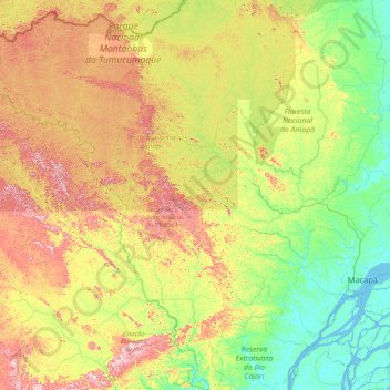
Name: Topografische Karte Laranjal do Jari, Höhe, Relief.
Durchschnittliche Höhe: 167 m
Minimale Höhe: -6 m
Maximale Höhe: 671 m
Spenden
Andere topografische Karten
Klicken Sie auf eine Karte, um ihre Topografie, ihre Höhe und ihr Relief anzuzeigen.
Amazon River
During what many archaeologists called the formative stage, Amazonian societies were deeply involved in the emergence of South America's highland agrarian systems. The trade with Andean civilizations in the terrains of the headwaters in the Andes formed an essential contribution to the social and religious…
Durchschnittliche Höhe: 10 m
Spenden