
Topografische Karte Dhemaji
Klicken Sie auf die Karte, um die Höhe anzuzeigen.
Dhemaji
Dhemaji is located at 27°29′N 94°35′E / 27.48°N 94.58°E / 27.48; 94.58. It has an average elevation of 91 metres (298 feet). Dhemaji is located to the north of the river Brahmaputra. To its north lies the Arunachal Himalayas. To its east lies the state, Arunachal Pradesh and to the west is Lakhimpur, a district of Assam. It has many large and small rivers flowing through it. Some of them are Jiadhal, Gainodi, Dikhari, Dihang, Dimow and Simen. The Subansiri River flows by its western border.
Über diese Karte
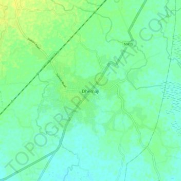
Name: Topografische Karte Dhemaji, Höhe, Relief.
Ort: Dhemaji, Assam, 787057, India (27.43638 94.52296 27.51638 94.60296)
Durchschnittliche Höhe: 102 m
Minimale Höhe: 95 m
Maximale Höhe: 112 m