Geolokalisieren
👉 Easily get elevation data in JSON, GeoTIFF and KML formats using Elevation API
Vielen Dank für die Unterstützung dieser Website ❤️
Spenden

Topografische Karte Lincoln

Klicken Sie auf die Karte, um die Höhe anzuzeigen.

👉 Easily get elevation data in JSON, GeoTIFF and KML formats using Elevation API
Vielen Dank für die Unterstützung dieser Website ❤️
Spenden

Über diese Karte

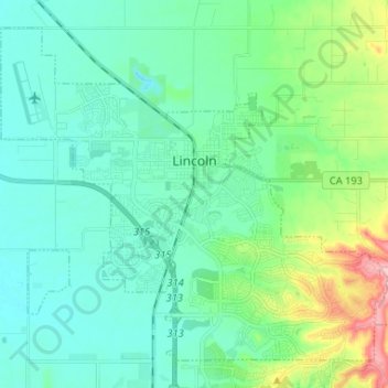
Name: Topografische Karte Lincoln, Höhe, Relief.

Ort: Lincoln, Placer County, California, 95648, United States (38.83915 -121.35846 38.92646 -121.22793)

Durchschnittliche Höhe: 60 m

Minimale Höhe: 25 m

Maximale Höhe: 190 m

👉 Easily get elevation data in JSON, GeoTIFF and KML formats using Elevation API
Vielen Dank für die Unterstützung dieser Website ❤️
Spenden

Andere topografische Karten

Klicken Sie auf eine Karte, um ihre Topografie, ihre Höhe und ihr Relief anzuzeigen.

Donner Pass

United States > California > Placer County

Durchschnittliche Höhe: 2.164 m

Alpine Meadows

United States > California > Placer County

Durchschnittliche Höhe: 2.163 m

Olympic Valley

United States > California > Placer County

Durchschnittliche Höhe: 2.082 m

Tahoe City

United States > California > Placer County

Durchschnittliche Höhe: 1.977 m

Vielen Dank für die Unterstützung dieser Website ❤️
Spenden

Norden

United States > California > Placer County

Durchschnittliche Höhe: 2.204 m

Dutch Flat

United States > California > Placer County

Durchschnittliche Höhe: 978 m

Cisco Grove

United States > California > Placer County

Durchschnittliche Höhe: 1.882 m

Silver Peak

United States > California > Placer County

Durchschnittliche Höhe: 2.282 m

Vielen Dank für die Unterstützung dieser Website ❤️
Spenden

Foresthill

United States > California > Placer County > Foresthill

Durchschnittliche Höhe: 749 m

Whitney

United States > California > Placer County

Durchschnittliche Höhe: 42 m

Applegate

United States > California > Placer County

Durchschnittliche Höhe: 588 m

Homewood

United States > California > Placer County

Durchschnittliche Höhe: 2.014 m

Vielen Dank für die Unterstützung dieser Website ❤️
Spenden

Heather Glen

United States > California > Placer County

Durchschnittliche Höhe: 622 m

Serene Lakes

United States > California > Placer County

Durchschnittliche Höhe: 2.119 m

Meadow Vista

United States > California > Placer County > Meadow Vista

Durchschnittliche Höhe: 544 m

Kings Beach

United States > California > Placer County

Durchschnittliche Höhe: 1.955 m

Vielen Dank für die Unterstützung dieser Website ❤️
Spenden

Meadow Vista

United States > California > Placer County

Durchschnittliche Höhe: 559 m

Tahoe Vista

United States > California > Placer County

Durchschnittliche Höhe: 1.955 m

Donner Peak

United States > California > Placer County

Donner Peak is an 8,019-foot-elevation (2,444-meter) summit in Placer County, California, United States.

Durchschnittliche Höhe: 2.171 m

Lincoln

United States > California > Placer County > Lincoln

Durchschnittliche Höhe: 60 m

Vielen Dank für die Unterstützung dieser Website ❤️
Spenden

Alta

United States > California > Placer County

Durchschnittliche Höhe: 1.107 m

Folsom Lake

United States > California > Placer County > Folsom

Durchschnittliche Höhe: 223 m

Carnelian Bay

United States > California > Placer County

For statistical purposes, the United States Census Bureau has defined Carnelian Bay as a census-designated place (CDP). The census definition of the area may not precisely correspond to local understanding of the area with the same name. The population was 524 at the 2010 census. The elevation is 6,325 feet…

Durchschnittliche Höhe: 1.977 m

Olympic Valley

United States > California > Placer County

Durchschnittliche Höhe: 2.082 m

Vielen Dank für die Unterstützung dieser Website ❤️
Spenden

Weimar

United States > California > Placer County

Durchschnittliche Höhe: 662 m

Iowa Hill

United States > California > Placer County

Durchschnittliche Höhe: 804 m

Meadow Vista

United States > California > Placer County

Durchschnittliche Höhe: 544 m

Dutch Flat

United States > California > Placer County

Durchschnittliche Höhe: 978 m

Vielen Dank für die Unterstützung dieser Website ❤️
Spenden

Donner Pass

United States > California > Placer County

Durchschnittliche Höhe: 2.164 m

Emigrant Gap

United States > California > Placer County

Durchschnittliche Höhe: 1.563 m

Tahoe City

United States > California > Placer County

Durchschnittliche Höhe: 1.977 m

Kings Beach

United States > California > Placer County

Durchschnittliche Höhe: 1.955 m

Vielen Dank für die Unterstützung dieser Website ❤️
Spenden

Kings Beach

United States > California > Placer County

Durchschnittliche Höhe: 1.955 m

Baxter

United States > California > Placer County

Durchschnittliche Höhe: 1.232 m

Foresthill

United States > California > Placer County

Durchschnittliche Höhe: 859 m

Cedar Flat

United States > California > Placer County

Durchschnittliche Höhe: 1.965 m

Vielen Dank für die Unterstützung dieser Website ❤️
Spenden

Olympic Valley

United States > California > Placer County

Durchschnittliche Höhe: 2.082 m

Tahoma

United States > California > Placer County

Durchschnittliche Höhe: 1.923 m

Applegate

United States > California > Placer County

Durchschnittliche Höhe: 588 m

Applegate

United States > California > Placer County

Durchschnittliche Höhe: 588 m

Vielen Dank für die Unterstützung dieser Website ❤️
Spenden

Serene Lakes

United States > California > Placer County

Durchschnittliche Höhe: 2.119 m

Olympic Valley

United States > California > Placer County

Durchschnittliche Höhe: 2.082 m

Blue Canyon

United States > California > Placer County

Blue Canyon (also, Blue Cañon) is an unincorporated community in Placer County, California. Blue Canyon is located 4 miles (6.4 km) southwest of Emigrant Gap. It lies at an elevation of 4695 feet (1431 m).

Durchschnittliche Höhe: 1.452 m

Lincoln

United States > California > Placer County

Durchschnittliche Höhe: 34 m

Vielen Dank für die Unterstützung dieser Website ❤️
Spenden