
Vielen Dank für die Unterstützung dieser Website ❤️
Spenden
Spenden
Topografische Karte Jhabua
Klicken Sie auf die Karte, um die Höhe anzuzeigen.
Vielen Dank für die Unterstützung dieser Website ❤️
Spenden
Spenden
Jhabua
Jhabua has an average elevation of 318 metres (1043 feet). Jhabua is located at the bottom left side of MP, mainly towards Gujarat.
Vielen Dank für die Unterstützung dieser Website ❤️
Spenden
Spenden
Über diese Karte
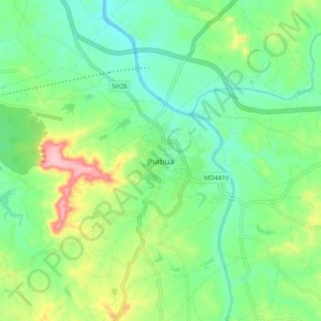
Name: Topografische Karte Jhabua, Höhe, Relief.
Durchschnittliche Höhe: 337 m
Minimale Höhe: 290 m
Maximale Höhe: 438 m
Vielen Dank für die Unterstützung dieser Website ❤️
Spenden
Spenden