

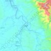
Topografische Karte Magat Dam
Klicken Sie auf die Karte, um die Höhe anzuzeigen.
Über diese Karte

Name: Topografische Karte Magat Dam, Höhe, Relief.
Ort: Magat Dam, Isabela, Cagayan Valley, Philippines (16.80412 121.44772 16.83477 121.45784)
Durchschnittliche Höhe: 176 m
Minimale Höhe: 104 m
Maximale Höhe: 294 m
Andere topografische Karten
Klicken Sie auf eine Karte, um ihre Topografie, ihre Höhe und ihr Relief anzuzeigen.
Ilagan
Abuan River is the main river of the Northern Sierra Madre Natural Park. It has an average elevation of 82 meters above sea level, and feeds the Abuan watershed in the city. Tourists and visitors can explore the diverse animal and plant life in one of the country’s remaining lush virgin forests. On January…
Durchschnittliche Höhe: 123 m


