
Topografische Karte Îlet à Fajou
Interaktive Karte
Klicken Sie auf die Karte, um die Höhe anzuzeigen.
Über diese Karte
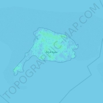
Name: Topografische Karte Îlet à Fajou, Höhe, Relief.
Ort: Îlet à Fajou, Les Abymes, Pointe-à-Pitre, Guadeloupe, France (16.34122 -61.59708 16.35379 -61.57917)
Durchschnittliche Höhe: 0 m
Minimale Höhe: -2 m
Maximale Höhe: 4 m
Andere topografische Karten
Klicken Sie auf eine Karte, um ihre Topografie, ihre Höhe und ihr Relief anzuzeigen.
Vieux-Bourg
France > Guadeloupe > Les Abymes
Vieux-Bourg, Les Abymes, Pointe-à-Pitre, Guadeloupe, 97183, France
Durchschnittliche Höhe: 11 m
Dothémare
France > Guadeloupe > Les Abymes
Dothémare, Les Abymes, Pointe-à-Pitre, Guadeloupe, 97139, France
Durchschnittliche Höhe: 18 m
Boisvin
France > Guadeloupe > Les Abymes > Boisvin
Boisvin, Les Abymes, Pointe-à-Pitre, Guadeloupe, 97139, France
Durchschnittliche Höhe: 40 m
Papin
France > Guadeloupe > Les Abymes
Papin, Les Abymes, Pointe-à-Pitre, Guadeloupe, France
Durchschnittliche Höhe: 65 m
Les Abymes
France > Guadeloupe > Les Abymes
Les Abymes, Pointe-à-Pitre, Guadeloupe, France
Durchschnittliche Höhe: 19 m