
Topografische Karte Gardens by the Bay
Interaktive Karte
Klicken Sie auf die Karte, um die Höhe anzuzeigen.
Über diese Karte
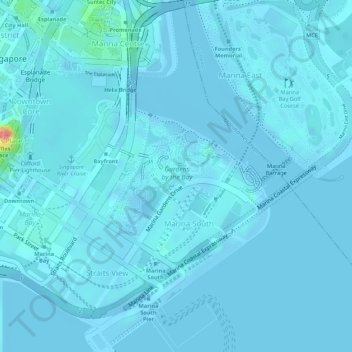
Name: Topografische Karte Gardens by the Bay, Höhe, Relief.
Durchschnittliche Höhe: 5 m
Minimale Höhe: -12 m
Maximale Höhe: 97 m
Andere topografische Karten
Klicken Sie auf eine Karte, um ihre Topografie, ihre Höhe und ihr Relief anzuzeigen.
Singapore Botanic Gardens
Singapore > Central > Singapore
Singapore Botanic Gardens, 1, Tanglin, Singapore, Central, 259569, Singapore
Durchschnittliche Höhe: 22 m
Kallang River
Singapore > Central > Singapore
Kallang River, Bishan, Singapore, Central, 569983, Singapore
Durchschnittliche Höhe: 26 m
Mount Faber
Singapore > Central > Singapore
Mount Faber, Singapore, Central, 099171, Singapore
Durchschnittliche Höhe: 21 m
Fort Canning Park
Singapore > Central > Singapore
Fort Canning Park, Museum, Singapore, Central, Singapore
Durchschnittliche Höhe: 19 m
Pearl's Hill City Park
Singapore > Central > Singapore
Pearl's Hill City Park, Outram, Singapore, Central, Singapore
Durchschnittliche Höhe: 18 m
Botanical Garden Gallop extension
Singapore > Central > Singapore
Botanical Garden Gallop extension, Camwood Park, Tanglin, Singapore, Central, 257701, Singapore
Durchschnittliche Höhe: 22 m
Istana Park
Singapore > Central > Singapore
Istana Park, Museum, Singapore, Central, 238902, Singapore
Durchschnittliche Höhe: 19 m
Symphony Lake
Singapore > Central > Singapore
Symphony Lake, Camwood Park, Tanglin, Singapore, Central, Singapore
Durchschnittliche Höhe: 22 m
Kallang Basin
Singapore > Central > Singapore
Kallang Basin, Kallang, Singapore, Central, 119587, Singapore
Durchschnittliche Höhe: 9 m
Lilac Drive Playground
Singapore > Central > Singapore
Lilac Drive Playground, Seletar Hills, Serangoon North, Singapore, Central, Singapore
Durchschnittliche Höhe: 20 m