
Topografische Karte Hickory
Interaktive Karte
Klicken Sie auf die Karte, um die Höhe anzuzeigen.
Über diese Karte
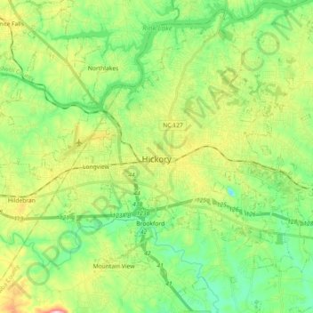
Name: Topografische Karte Hickory, Höhe, Relief.
Ort: Hickory, Catawba County, North Carolina, United States (35.66124 -81.40356 35.80737 -81.23537)
Durchschnittliche Höhe: 317 m
Minimale Höhe: 218 m
Maximale Höhe: 512 m
Lake Hickory was named after the City of Hickory and runs along its northern edge. The lake covers almost 4,223 acres (17.09 km2) with 105 miles (169 km) of shoreline. Full pond elevation is 935 feet (285 m). Lake Hickory is a reliable source of water for the Cities of Hickory and Conover and the Town of Long View, while also functioning as a recreation hub for boating, fishing, and other water based activities.
Andere topografische Karten
Klicken Sie auf eine Karte, um ihre Topografie, ihre Höhe und ihr Relief anzuzeigen.
Newton
United States > North Carolina > Catawba County
Newton, Catawba County, North Carolina, 28658, United States
Durchschnittliche Höhe: 287 m