
Topografische Karte Marfa
Interaktive Karte
Klicken Sie auf die Karte, um die Höhe anzuzeigen.
Über diese Karte
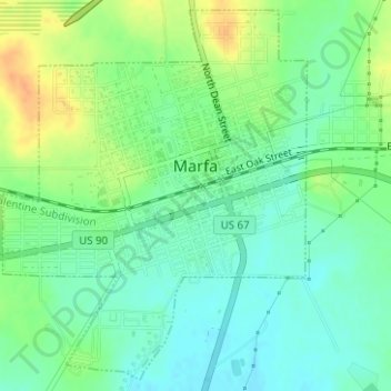
Name: Topografische Karte Marfa, Höhe, Relief.
Ort: Marfa, Presidio County, Texas, 79843, United States (30.29697 -104.03859 30.32254 -104.01421)
Durchschnittliche Höhe: 1.434 m
Minimale Höhe: 1.420 m
Maximale Höhe: 1.456 m
Marfa experiences a semi-arid climate (BSk) with hot summers and cool winters. Due to its elevation and aridity, the diurnal temperature variation is substantial.
Andere topografische Karten
Klicken Sie auf eine Karte, um ihre Topografie, ihre Höhe und ihr Relief anzuzeigen.
Marfa
United States > Texas > Presidio County > Marfa > Marfa
Marfa, Presidio County, Texas, 70843, United States
Durchschnittliche Höhe: 1.448 m
Cathedral Peak
United States > Texas > Presidio County
Cathedral Peak, Presidio County, Texas, United States
Durchschnittliche Höhe: 1.375 m