
Topografische Karte Greenwood
Interaktive Karte
Klicken Sie auf die Karte, um die Höhe anzuzeigen.
Greenwood
Greenwood's mean elevation is 813 feet (248 m) above sea level. The city's topography is flat to gently rolling.
Über diese Karte
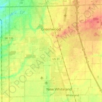
Name: Topografische Karte Greenwood, Höhe, Relief.
Ort: Greenwood, Johnson County, Indiana, United States (39.54837 -86.16704 39.63693 -86.04000)
Durchschnittliche Höhe: 245 m
Minimale Höhe: 216 m
Maximale Höhe: 270 m
Andere topografische Karten
Klicken Sie auf eine Karte, um ihre Topografie, ihre Höhe und ihr Relief anzuzeigen.