
Topografische Karte Town of Theresa
Interaktive Karte
Klicken Sie auf die Karte, um die Höhe anzuzeigen.
Über diese Karte
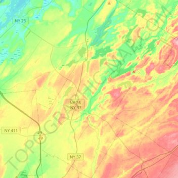
Name: Topografische Karte Town of Theresa, Höhe, Relief.
Durchschnittliche Höhe: 120 m
Minimale Höhe: 72 m
Maximale Höhe: 180 m
Andere topografische Karten
Klicken Sie auf eine Karte, um ihre Topografie, ihre Höhe und ihr Relief anzuzeigen.
Millsite Lake
United States > New York > Jefferson County > Town of Theresa
Millsite Lake, Town of Theresa, Jefferson County, New York, United States
Durchschnittliche Höhe: 107 m
Watertown
United States > New York > Jefferson County
Watertown, City of Watertown, Jefferson County, New York, 13601, United States
Durchschnittliche Höhe: 196 m
Village of Antwerp
United States > New York > Jefferson County > Town of Antwerp
Village of Antwerp, Town of Antwerp, Jefferson County, New York, United States
Durchschnittliche Höhe: 160 m
Town of Hounsfield
United States > New York > Jefferson County
Town of Hounsfield, Jefferson County, New York, 13685, United States
Durchschnittliche Höhe: 150 m
Beebee's Island
United States > New York > Jefferson County > City of Watertown
Beebee's Island, City of Watertown, Jefferson County, New York, 13601, United States
Durchschnittliche Höhe: 204 m
Village of Dexter
United States > New York > Jefferson County > Town of Brownville
Village of Dexter, Town of Brownville, Jefferson County, New York, United States
Durchschnittliche Höhe: 96 m
Village of Sackets Harbor
United States > New York > Jefferson County
Village of Sackets Harbor, Town of Hounsfield, Jefferson County, New York, 13685, United States
Durchschnittliche Höhe: 82 m
Village of West Carthage
United States > New York > Jefferson County
Village of West Carthage, Town of Champion, Jefferson County, New York, United States
Durchschnittliche Höhe: 231 m
Village of Philadelphia
United States > New York > Jefferson County
Village of Philadelphia, Town of Philadelphia, Jefferson County, New York, 13673, United States
Durchschnittliche Höhe: 149 m
Bayview
United States > New York > Jefferson County
Bayview, Town of Lyme, Jefferson County, New York, 13693, United States
Durchschnittliche Höhe: 81 m
Murray Isle
United States > New York > Jefferson County > Town of Clayton > Grenell
Murray Isle, Grenell, Town of Clayton, Jefferson County, New York, United States
Durchschnittliche Höhe: 78 m
Butterfield Lake
United States > New York > Jefferson County > Town of Theresa > Redwood
Butterfield Lake, Redwood, Town of Theresa, Town of Alexandria, Jefferson County, New York, United States
Durchschnittliche Höhe: 99 m
Village of Carthage
United States > New York > Jefferson County
Village of Carthage, Town of Wilna, Jefferson County, New York, 13619, United States
Durchschnittliche Höhe: 228 m
Fort Drum
United States > New York > Jefferson County
Fort Drum, Town of Le Ray, Jefferson County, New York, United States
Durchschnittliche Höhe: 174 m
Town of Adams
United States > New York > Jefferson County
Town of Adams, Jefferson County, New York, United States
Durchschnittliche Höhe: 182 m
Village of Black River
United States > New York > Jefferson County
Village of Black River, Town of Le Ray, Jefferson County, New York, United States
Durchschnittliche Höhe: 193 m
Village of Brownville
United States > New York > Jefferson County > Town of Brownville
Village of Brownville, Town of Brownville, Jefferson County, New York, 13615, United States
Durchschnittliche Höhe: 110 m
Village of Theresa
United States > New York > Jefferson County > Town of Theresa
Village of Theresa, Town of Theresa, Jefferson County, New York, 13691, United States
Durchschnittliche Höhe: 121 m
Henderson
United States > New York > Jefferson County > Henderson
Henderson, Jefferson County, New York, United States
Durchschnittliche Höhe: 101 m
Warren
United States > New York > Jefferson County > Warren
Warren, Cape Vincent, Jefferson County, New York, United States
Durchschnittliche Höhe: 99 m
Cape Vincent
United States > New York > Jefferson County > Cape Vincent
Cape Vincent, Jefferson County, New York, United States
Durchschnittliche Höhe: 84 m
Adams Center
United States > New York > Jefferson County > Adams Center
Adams Center, Town of Adams, Jefferson County, New York, 13606, United States
Durchschnittliche Höhe: 194 m
Calcium
United States > New York > Jefferson County
Calcium, Town of Le Ray, Jefferson County, New York, 13616, United States
Durchschnittliche Höhe: 154 m
Holiday Island
United States > New York > Jefferson County
Holiday Island, Town of Orleans, Jefferson County, New York, 13640, United States
Durchschnittliche Höhe: 113 m