Geolokalisieren

Topografische Karte Dale Hodges Park

Interaktive Karte

Klicken Sie auf die Karte, um die Höhe anzuzeigen.

Über diese Karte

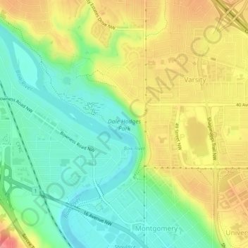
Name: Topografische Karte Dale Hodges Park, Höhe, Relief.

Ort: Dale Hodges Park, Montgomery, Calgary, Alberta, Canada (51.08004 -114.17983 51.09220 -114.16331)

Durchschnittliche Höhe: 1.092 m

Minimale Höhe: 1.057 m

Maximale Höhe: 1.137 m

Andere topografische Karten

Klicken Sie auf eine Karte, um ihre Topografie, ihre Höhe und ihr Relief anzuzeigen.

Calgary

Canada > Alberta > Calgary

Durchschnittliche Höhe: 1.106 m

Acadia

Canada > Alberta > Calgary

Durchschnittliche Höhe: 1.049 m

Marlborough

Canada > Alberta > Calgary

Durchschnittliche Höhe: 1.078 m

Acadia

Canada > Alberta > Calgary

Durchschnittliche Höhe: 1.049 m

Southwood

Canada > Alberta > Calgary

Durchschnittliche Höhe: 1.072 m

Silverado

Canada > Alberta > Calgary

Durchschnittliche Höhe: 1.073 m

Eagle Ridge

Canada > Alberta > Calgary

Durchschnittliche Höhe: 1.081 m

Wolf Willow

Canada > Alberta > Calgary

Durchschnittliche Höhe: 1.014 m

Whitehorn

Canada > Alberta > Calgary

Durchschnittliche Höhe: 1.091 m

Beltline

Canada > Alberta > Calgary

Durchschnittliche Höhe: 1.059 m

Abbeydale

Canada > Alberta > Calgary

Durchschnittliche Höhe: 1.067 m

Applewood Park

Canada > Alberta > Calgary

Durchschnittliche Höhe: 1.062 m

Fish Creek Park

Canada > Alberta > Calgary

Durchschnittliche Höhe: 1.044 m

Fish Creek Provincial Park

Canada > Alberta > Calgary

Durchschnittliche Höhe: 1.113 m

Bridlewood

Canada > Alberta > Calgary

Durchschnittliche Höhe: 1.107 m

Bow River

Canada > Alberta > Calgary

Durchschnittliche Höhe: 1.091 m

Glenmore Reservoir

Canada > Alberta > Calgary

Durchschnittliche Höhe: 1.085 m

Yorkville

Canada > Alberta > Calgary

Durchschnittliche Höhe: 1.078 m

Sunalta

Canada > Alberta > Calgary

Durchschnittliche Höhe: 1.071 m