Topografische Karte Kohima
Klicken Sie auf die Karte, um die Höhe anzuzeigen.
Über diese Karte
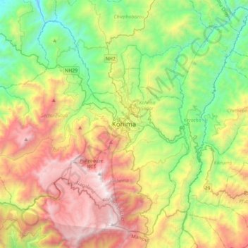
Name: Topografische Karte Kohima, Höhe, Relief.
Durchschnittliche Höhe: 1.425 m
Minimale Höhe: 430 m
Maximale Höhe: 2.993 m

Klicken Sie auf die Karte, um die Höhe anzuzeigen.
Name: Topografische Karte Kohima, Höhe, Relief.
Durchschnittliche Höhe: 1.425 m
Minimale Höhe: 430 m
Maximale Höhe: 2.993 m