
Vielen Dank für die Unterstützung dieser Website ❤️
Spenden
Spenden
Topografische Karte Pyrenäen
Klicken Sie auf die Karte, um die Höhe anzuzeigen.
Vielen Dank für die Unterstützung dieser Website ❤️
Spenden
Spenden
Pyrenäen
Topographische Karte der Pyrenäen
Vielen Dank für die Unterstützung dieser Website ❤️
Spenden
Spenden
Über diese Karte
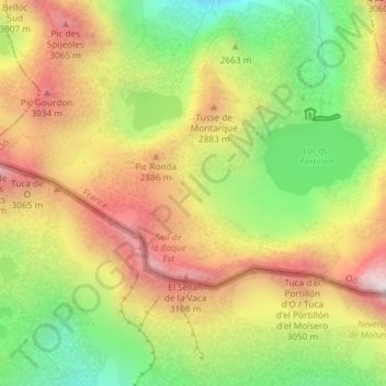
Name: Topografische Karte Pyrenäen, Höhe, Relief.
Durchschnittliche Höhe: 2.716 m
Minimale Höhe: 2.265 m
Maximale Höhe: 3.168 m
Vielen Dank für die Unterstützung dieser Website ❤️
Spenden
Spenden