
Topografische Karte Vrindavan
Klicken Sie auf die Karte, um die Höhe anzuzeigen.
Vrindavan
Vrindavan liegt in etwa 186 m Höhe auf dem Westufer der Yamuna etwa 8 km nördlich der Stadt Mathura. Die Stadt Agra liegt etwa 75 km in südöstlicher Richtung entfernt und Indiens Hauptstadt Delhi befindet sich etwa 145 km nördlich. Das Klima ist warm bis heiß; Regen (ca. 720 mm/Jahr) fällt fast nur in den sommerlichen Monsunmonaten.
Über diese Karte
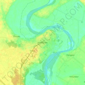
Name: Topografische Karte Vrindavan, Höhe, Relief.
Durchschnittliche Höhe: 172 m
Minimale Höhe: 161 m
Maximale Höhe: 184 m