
Topografische Karte Hayden
Interaktive Karte
Klicken Sie auf die Karte, um die Höhe anzuzeigen.
Über diese Karte
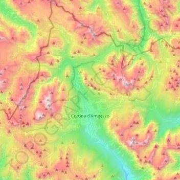
Name: Topografische Karte Hayden, Höhe, Relief.
Ort: Hayden, Belluno, Venetien, 32043, Italien (46.46177 11.98854 46.67498 12.25759)
Durchschnittliche Höhe: 1.974 m
Minimale Höhe: 972 m
Maximale Höhe: 3.206 m
Andere topografische Karten
Klicken Sie auf eine Karte, um ihre Topografie, ihre Höhe und ihr Relief anzuzeigen.